Welcome
Northwest Highway (Loop 12) Feasibility Study – From Inwood Rd. to Hillcrest Ave.
Thank you for your participation in our virtual public meeting! The entire session should take no more than 20 minutes to complete. This virtual public meeting consists of presentation materials explaining the study purpose, concepts to be analyzed, and the process for evaluation. The virtual public meeting will be live December 7, 2020 and will remain available online through the comment period deadline of December 22, 2020.
Virtual Public Meeting in Response to Public Health
TxDOT changed the in-person public meeting to a virtual format only, in response to the COVID-19 outbreak. The virtual public meeting and TxDOT website will provide the same information as an in-person meeting would have.
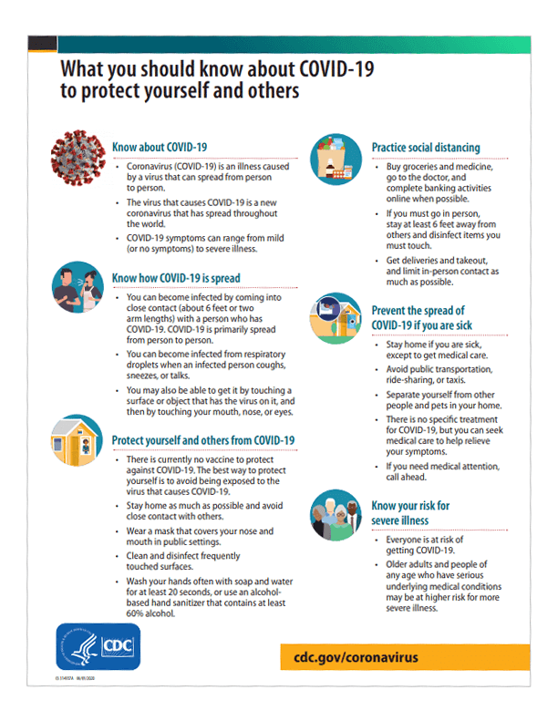
Additional COVID-19 information is available. Please review the latest Center for Disease Control and Prevention handout to learn more.
Meeting Purpose
- Inform the public of project status and present recommendations.
- Describe the project so the public can determine how they may be affected.
- Provide the public the opportunity to contribute input.
- Develop a record of public participation.
How to Navigate
- Click the arrow on the right side of your screen.
- Use the navigation bar at the left of your screen to revisit any part of the meeting.
- Click through all 8 pages to view all materials.
What is a Feasibility Study?
A feasibility study is conducted to analyze potential transportation options, including improving the existing alignment.
- Helps determine if the project should move on to more advanced phases of project development
- Do nothing (No Build) is a possible outcome
- Identifies high-level or critical elements of engineering, impacts to stakeholders and the public, and economic feasibility of potential new roadways or improvements to existing roadways
- Feasibility studies are not intended to result in detailed design, environmental analysis, or cost estimates
- A preliminary cost estimate is created to determine the feasibility of funding a project
Study Overview
Where is the study and what is involved?
Study Location
The Northwest Highway Feasibility Study project limits include Northwest Highway, also known as Loop 12, from Inwood Road to Hillcrest Avenue in Dallas County, Texas
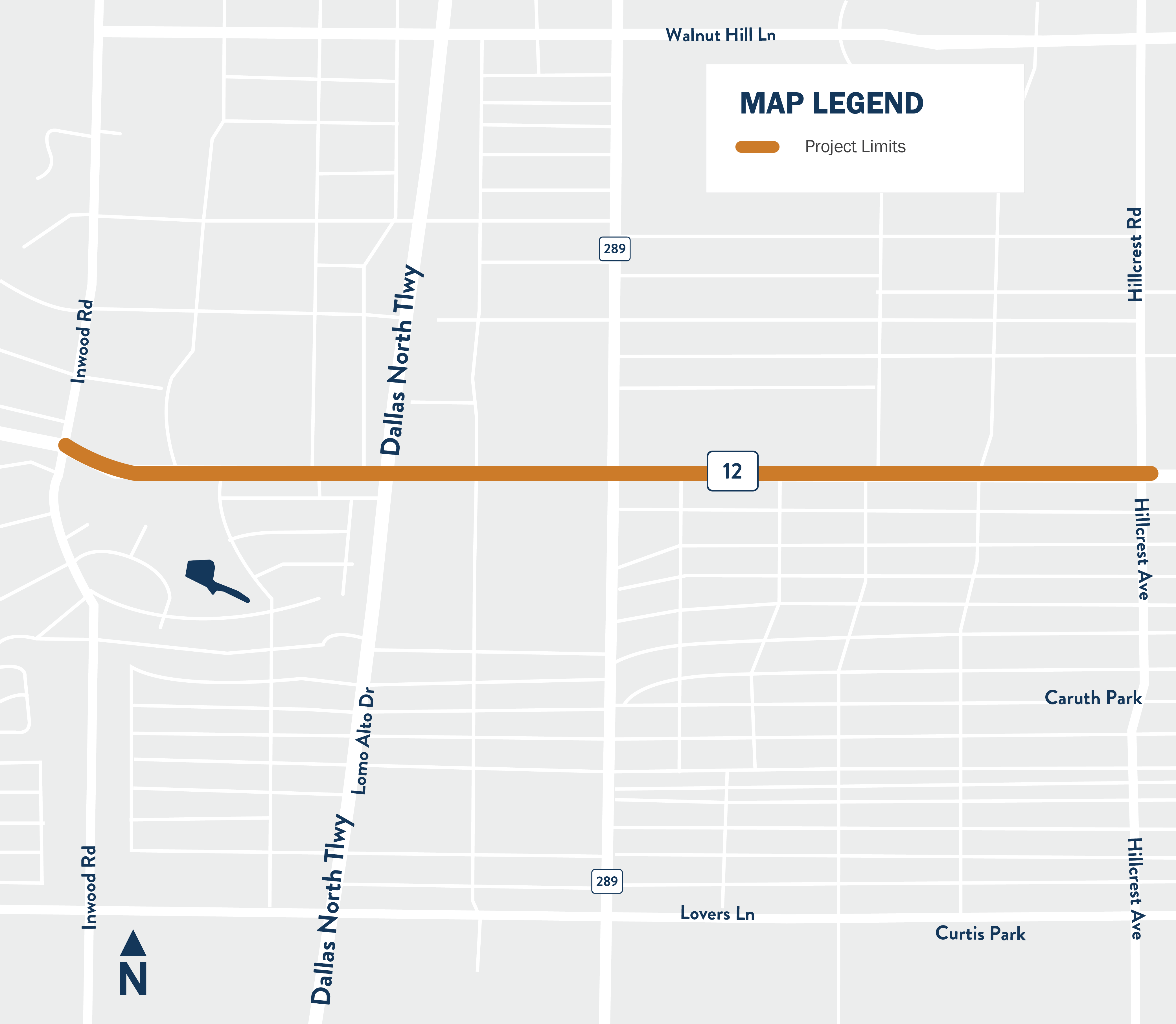
Click the image above to enlarge.
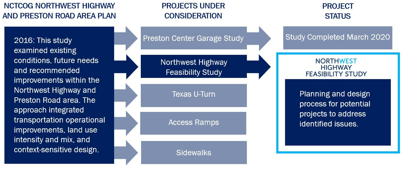
The Northwest Highway Feasibility Study intends to build on the Northwest Highway and Preston Road Area Plan completed by the North Central Texas Council of Governments in 2016. TxDOT was requested to evaluate options for the Northwest Highway corridor to further study traffic congestion, parking, walkability, and drainage.
Study Goals and Objectives
The study is anticipated to recommend one or more solutions that encompass several goals for the corridor. As always, safety is the highest priority for TxDOT. Concepts will also be analyzed for their ability to minimize impacts to the surrounding environment; their ability to improve traffic flow and mobility in the corridor using traditional strategies as well as new technology; their ability to provide alternative modes of travel including transit as well as improved facilities for bicycles and pedestrians; and finally, their ability to provide an efficient solution while minimizing cost and enhancing existing and proposed land uses. Additional goals may be identified for analysis.
- Safety: Increase safety for all transportation modes
- Environmental: Minimize impacts to the surrounding environment
- Traffic/Technology: Improve traffic flow in the project area
- Mobility Choice: Improve the user experience for non-car modes
- Value: Achieve a good return on investment

Existing Conditions
Existing Conditions Analysis
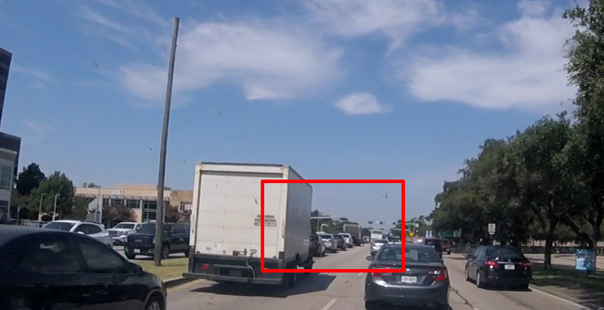
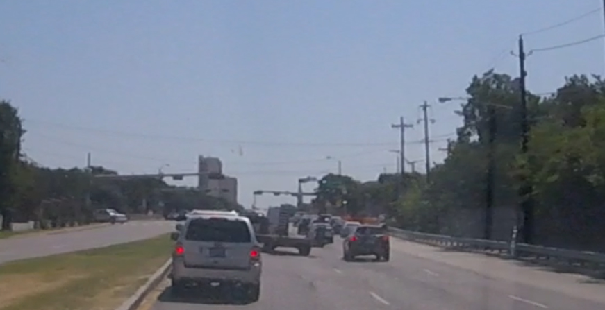
Several problem areas have been identified through the existing conditions analysis. Locations with overall congestion during peak hours, left-turn and intersection delays, crash hotspots, and sidewalk deficiencies are shown on the map below. If you know of other problem areas, please use the public input survey or interactive comment map available to provide input on your experience traveling along Northwest Highway.
 |
Intersection delays |
 |
Crash hotspots |
 |
Sidewalk deficiencies |
Map Legend
 |
Inwood Road
|
 |
Dallas North Tollway
|
 |
Dallas North Tollway
|
 |
Fire Station Signal
|
 |
Douglas Avenue
|
 |
Preston Road
|
 |
Pickwick Lane
|
 |
Thackery Street
|
 |
Hillcrest Avenue
|
Problems Identified
Photos of the corridor shown below represent some of the problem areas identified on the map above.
Lack of continuous sidewalks
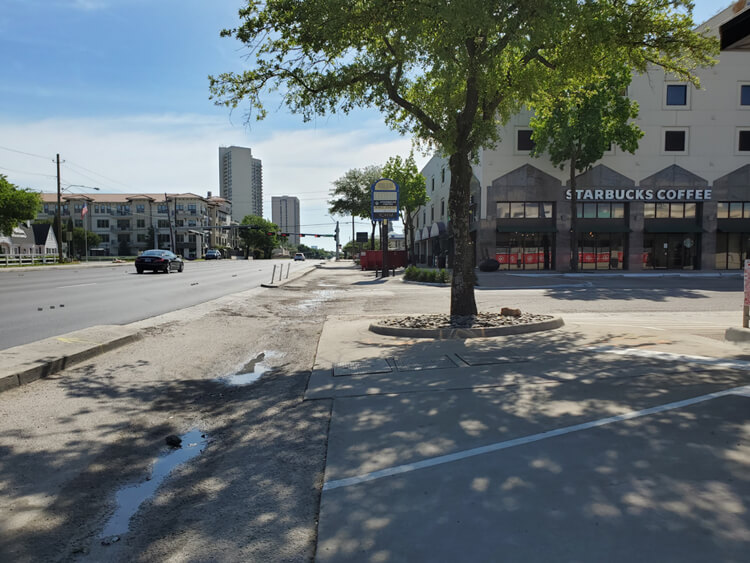
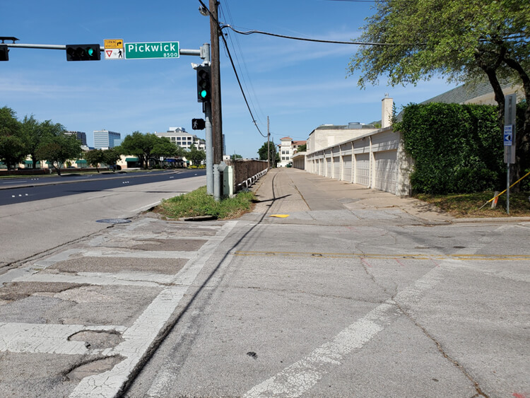
Left-turn delays and lane blockage due to traffic congestion
Traffic Projections
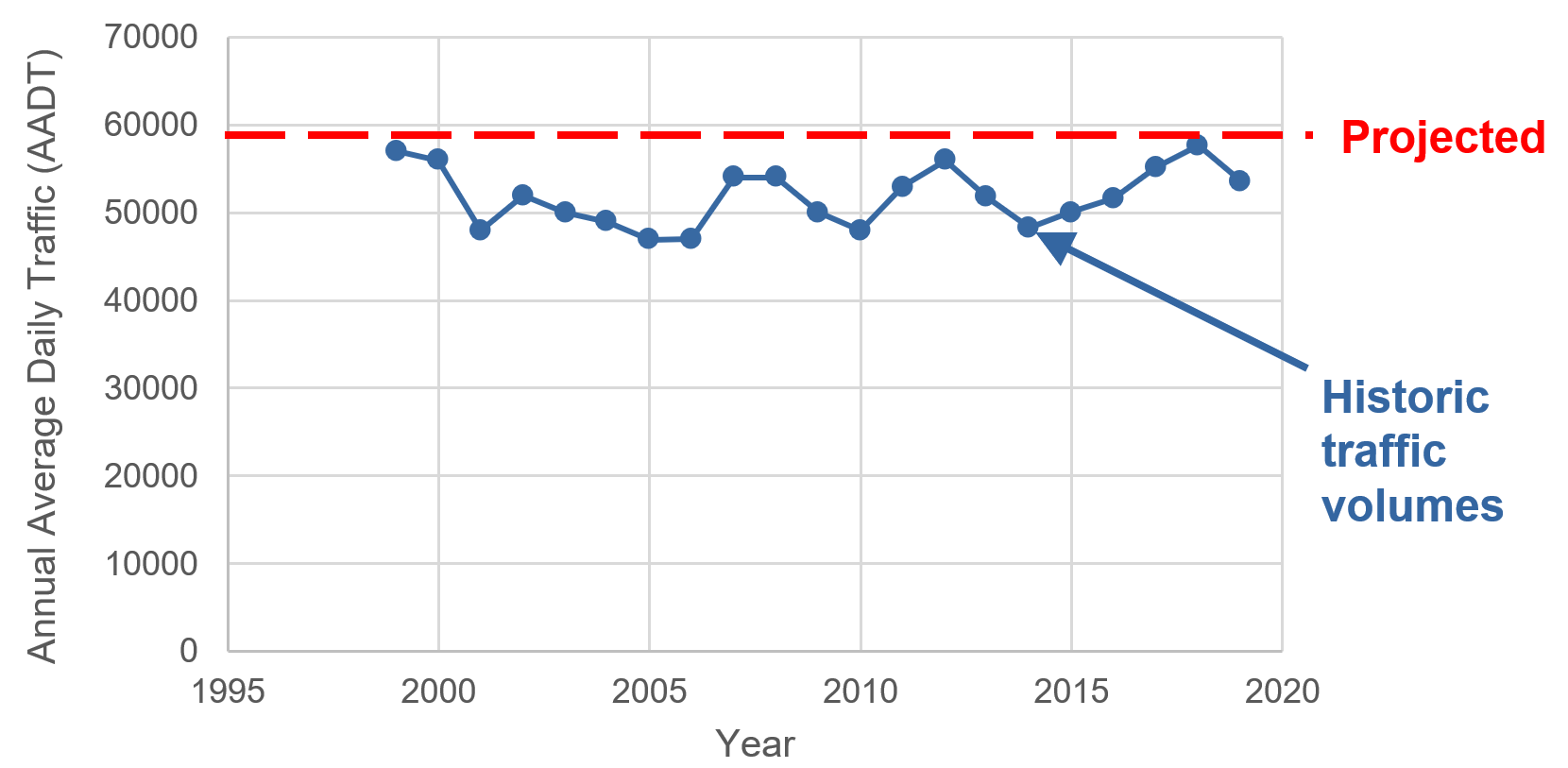
Traffic volumes have remained relatively constant over the past twenty years with volumes along Northwest Highway staying around 50,000 to 55,000 vehicles per day. The primary reason for this limited traffic growth is due to the corridor operating at its capacity while accommodating both local and pass-through traffic. Based on preliminary traffic analysis, traffic is anticipated to experience some growth, about 5% between 2020 and 2045, due to planned development in the study area.
*Traffic impacts from COVID-19 are assumed to be short-term for this study.
Initial Concepts
We are in the very early stages of this feasibility study and are presenting initial concepts and ideas for possible improvements to Northwest Highway. There will be additional future public meetings and opportunities to provide input. TxDOT welcomes your comments on how we can improve any of the concepts presented here. In a feasibility study, the existing conditions concept is always considered as a viable solution and is also used as the baseline to compare other concepts identified for analysis.
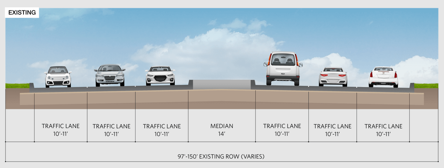
Existing Conditions (No Build)
Northwest Highway is currently configured with six lanes, three in each direction. Lane widths vary between 10 and 11 feet. Existing right-of-way varies between 97 and 150 feet wide. A raised median is present in some areas, but not the entire length of the study area. Right of way width of less than 120 feet for a six-lane arterial would not meet current design standards.
In a feasibility study, the existing conditions are studied as the baseline to compare concepts identified for analysis. The no build means no changes are made to the corridor for cars or other modes of travel and issues identified would continue.
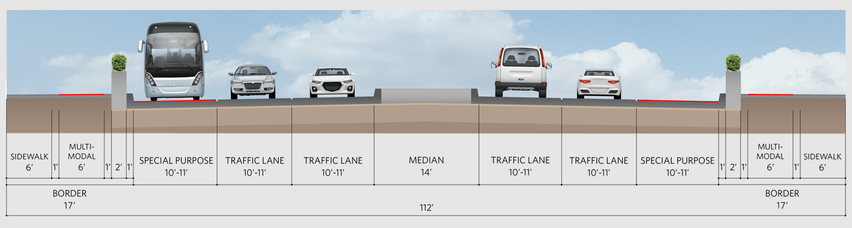
Early Concepts - Operational Improvements
Operational improvements could improve traffic flow for cars, provide better connectivity for bikes and pedestrians, and resolve existing drainage issues. Transit could be separated from congestion which may increase congestion in the other travel lanes. Additional right-of-way may or may not be needed.
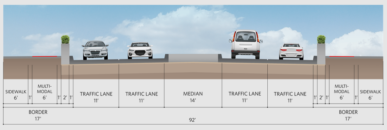
Early Concepts – Road Diet
A Road Diet may reduce the number of travel lanes to allow room for pedestrian and non-car modes of travel. Reducing the number of cars creates additional opportunities for bicycles and pedestrians to utilize the corridor. Traffic congestion may worsen for cars on Northwest Highway, and traffic may shift to adjacent parallel roadways. Right-of-way is not anticipated to be needed for this concept.
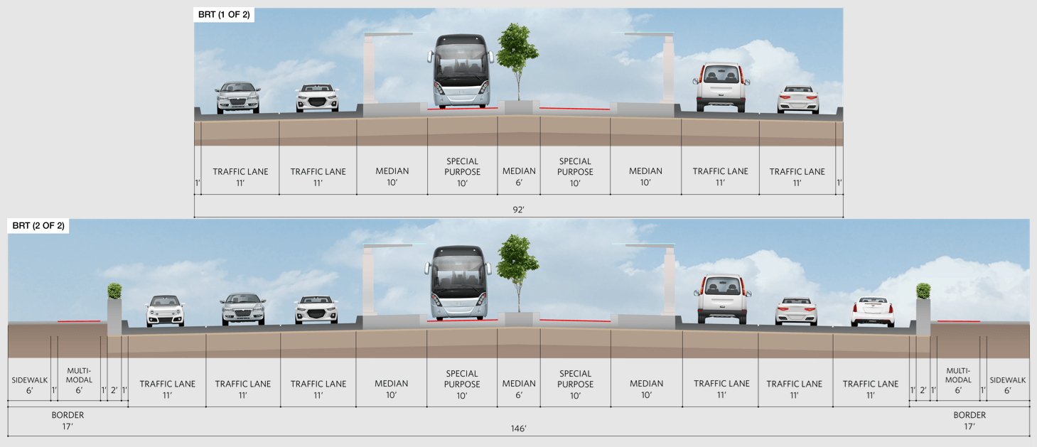
Early Concepts – Bus Rapid Transit
Bus Rapid Transit concepts include designated lanes for buses and consolidated bus stops. Car travel lanes could be reduced, and multi-modal lanes may also be added. Right-of-way may or may not be needed depending on final concept recommendation and design.
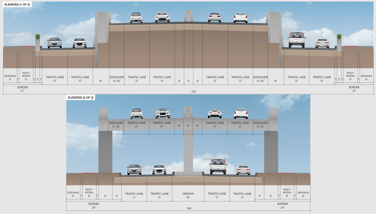
Early Concepts – Elevated
An Elevated roadway concept would require additional right-of-way for Northwest Highway and include lanes that are elevated above the existing roadway. The elevated lanes in this concept would be lanes that pass through the area and would not have access to businesses and homes in the corridor. The surface level lanes would have access to land uses adjacent to Northwest Highway. The beginning and end of the elevated section would be wider where the surface lanes and elevated lanes separate and would require additional right-of-way as seen in the image on top.
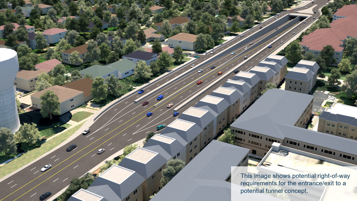
Early Concepts – Tunnel
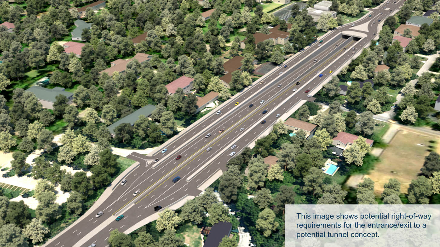
A tunnel concept would take travel lanes below the existing roadway and travelers would pass directly from one end of the tunnel to the other without the option of exiting. The surface level roadway above the tunnel lanes would allow for access along the Northwest Highway corridor. The beginning and end of the tunnel section would be wider where the surface lanes and tunnel lanes separate. The tunnel concept would require additional right-of-way in the portal areas.
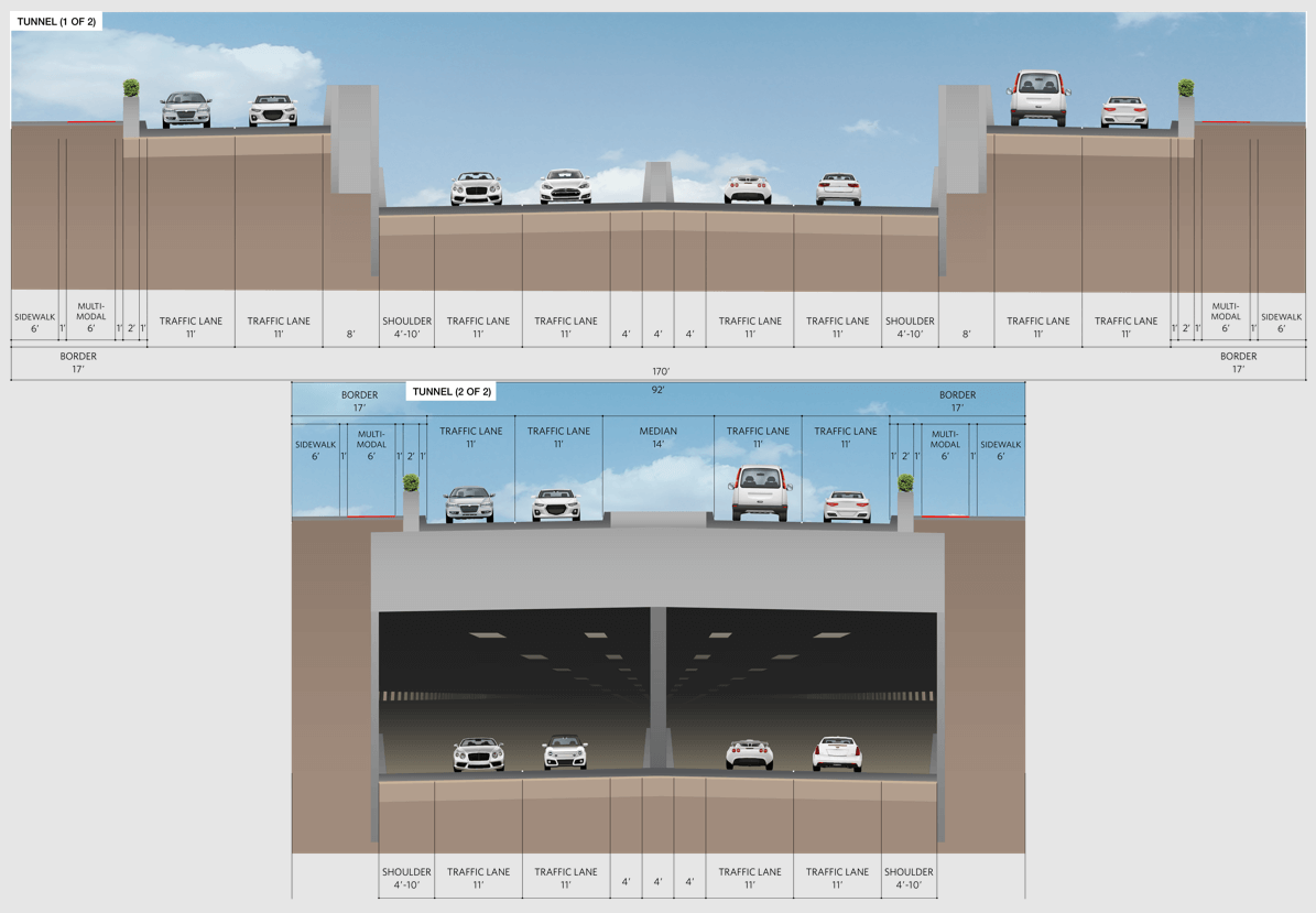
Portals
West Portal near Devonshire Drive
East Portal near Thackery Street
Tell Us What You Think
Operational Improvements
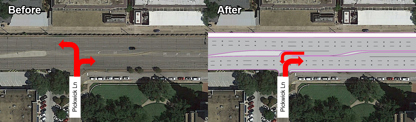
Improvements for non-car users such as pedestrians, cyclists, and transit may require additional right-of-way where space along the corridor is limited. Changes to the existing roadway configuration may be needed to provide multimodal facilities such as sidewalks and bike accommodations that are comfortable to use and operate effectively.
Potential priority multimodal connections include crossings at the Douglas Avenue, Preston Road, Pickwick Lane, and Edgemere Road intersections, connections along the south side of Northwest Highway between Douglas Avenue and Pickwick Lane, and connections along the north side of Northwest Highway between Preston Road and Edgemere Road.
Hooded Left-turns
Hooded left-turn lanes improve safety by reducing conflict points and can reduce delay on cross-streets by preventing left-turns. Hooded left-turns could be provided at crash hot spots where unsignalized left-turns are currently allowed.
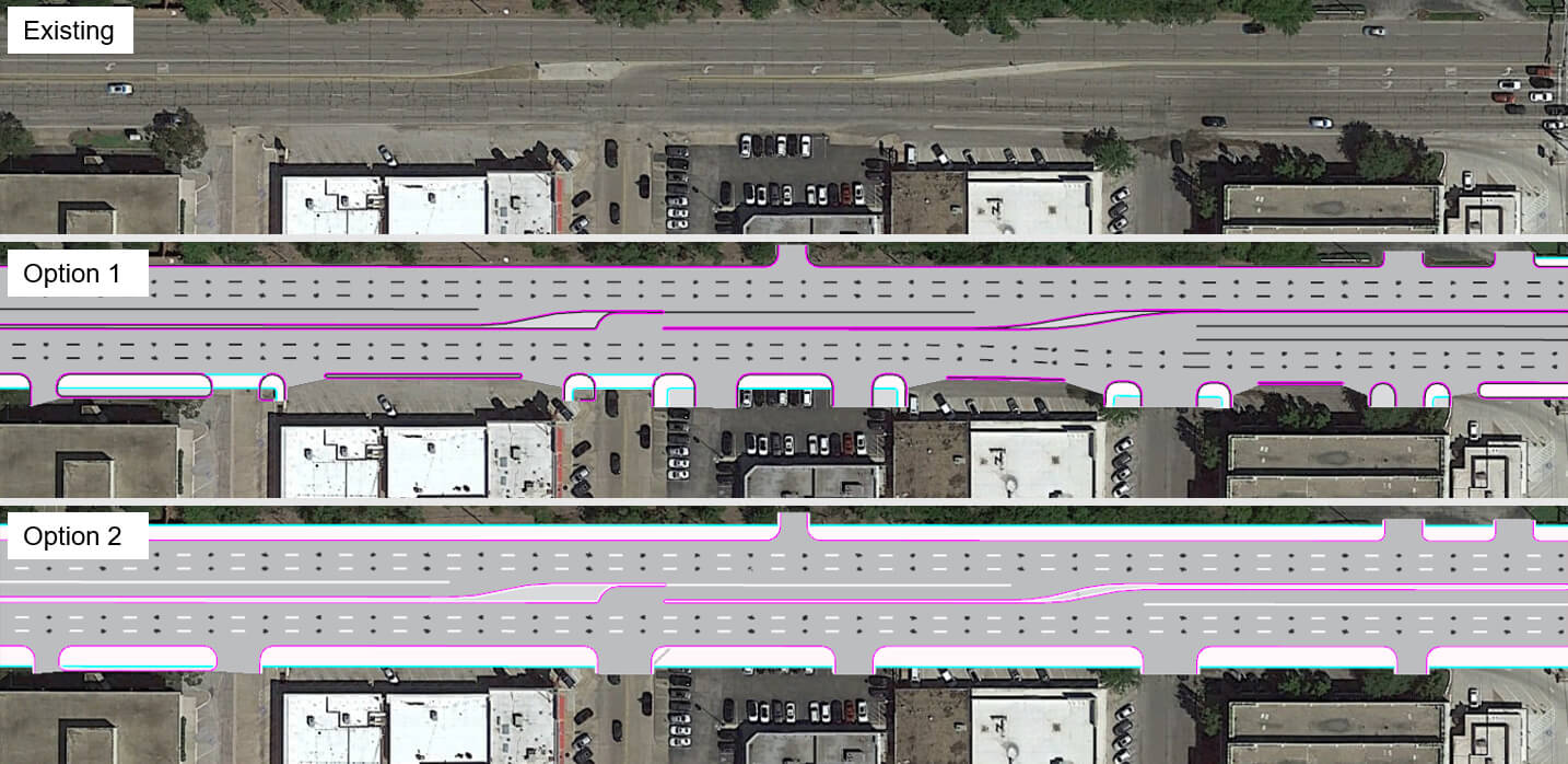
Driveway Consolidation
Driveway consolidation could benefit the corridor by reducing conflict points between entering and exiting traffic and between drivers and pedestrians or cyclists. Driveway consolidation could also create more space for multimodal facilities along the Northwest Highway corridor.
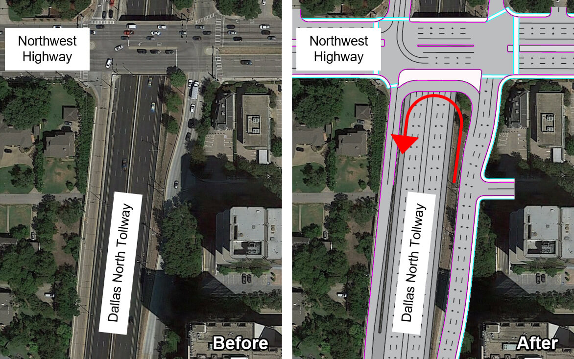
U-Turn at Dallas North Tollway
A U-turn at the Dallas North Tollway is being analyzed as an operational improvement to provide additional direct access between Preston Center West and the Dallas North Tollway. This would also reduce delays by removing traffic from the Dallas North Tollway and Douglas Avenue intersections.
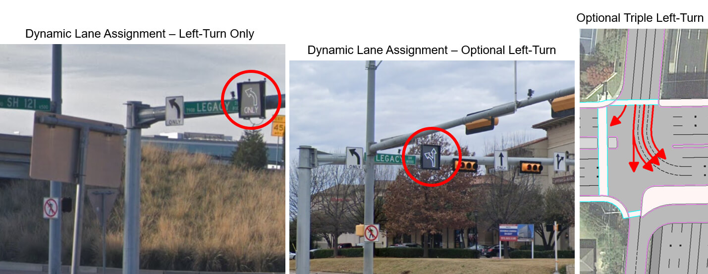
Turn Lanes/Dynamic Lane Assignment
Dynamic lane assignment and new turn lanes can provide additional intersection capacity during peak travel times and help to make intersections more adaptable to changes in demand or special events.
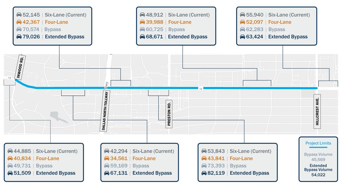
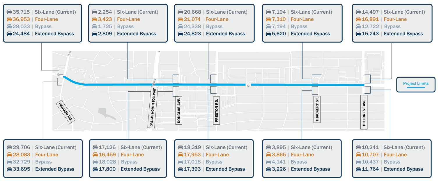
Traffic Projections and Shifts
As improvements are made to Northwest Highway, traffic would adjust depending on the concept chosen. The images below show how traffic on and near Northwest Highway is anticipated to change depending upon the concept(s) implemented.
Traffic Projection
The image below shows the amount of traffic anticipated along Northwest Highway in 2045 in the current six-lane configuration compared to three additional scenarios: one where Northwest Highway is reduced to four-lanes, one where a tunnel or elevated bypass is provided between Meadowbrook Drive and Pickwick Lane, and one where a tunnel or elevated bypass is provided between Meadowbrook Drive and Turtle Creek Boulevard.
Traffic Level of Service
The image below shows the expected level of service (LOS) for each of the four scenarios analyzed based on anticipated traffic in 2045. Level of service is designated by A (best) to F (worst) ratings.
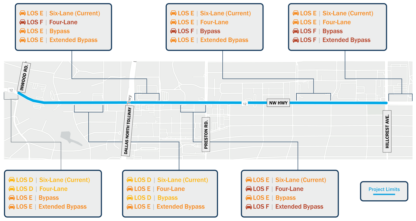
Click the images to enlarge.
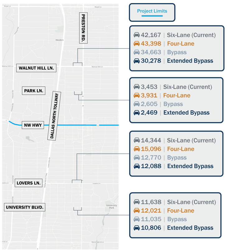
Traffic Shift – Parallel Roadways
The image shown here is the amount of traffic that would shift from Northwest Highway to adjacent parallel roadways based on each concept analyzed.
Traffic Shift – Cross Streets
The image below shows the amount of traffic anticipated on cross streets for each of the four scenarios analyzed. Traffic volumes on cross streets is expected to increase or decrease depending on the number of lanes provided on Northwest Highway.
Study Timeline and Next Steps
What’s Next?
Following this virtual public meeting, public input will be considered, and the concepts will continue to be studied and narrowed down, to identify one or more recommended concepts. The refined concepts will be presented at a public meeting tentatively planned for Spring 2021.
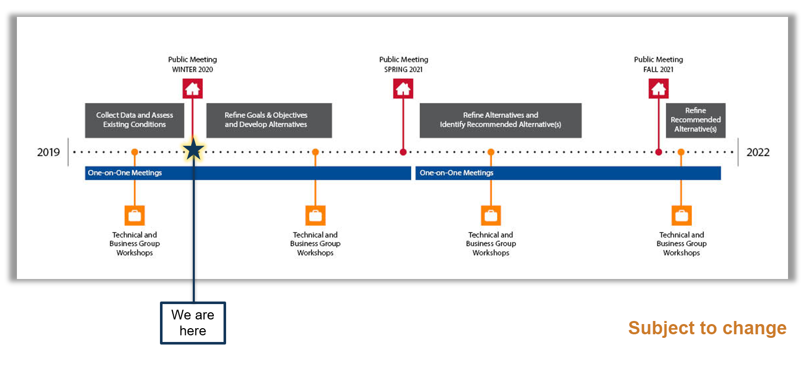
Click the image above to enlarge.
Comments and Study Contact Information
How you can provide comments and obtain additional information.
We Want to Hear From You!
Thank you for participating in the Northwest Highway (Loop 12) Feasibility Study virtual public meeting. We look forward to hearing from you. Please submit written or verbal comments by our deadline of December 22, 2020 using any of the methods outlined on this page.
Survey
We would like your input on the draft conceptual alignments presented in this public meeting. You can complete the survey as well as provide verbal or written comments. Click here to complete the survey.
Comment Map
Access the online interactive map here to explore the study area and provide input on issues and ideas you have for the corridor. Click here to launch the comment map.
Verbal Comments
A phone number has been established to receive your comments via voicemail. Please call (833) 933-0437 to record your message.
General Comment Form
To email or mail in your written comments, download a PDF (English or Spanish) of the general comment form and follow the mailing instructions provided.
Contact Us
Texas Department of Transportation
Stephen Endres, PE, Project Manager
Stephen.Endres@txdot.gov
(214) 320-4469
Right-of-Way Resources
Property owners have a legal right (Uniform Act) to fair compensation for their property. Several publications are available to help landowners understand the ROW acquisition process and are available through this Virtual Public Meeting. They include the State Purchase of Right of Way from TxDOT, and Relocation Assistance. The booklets are in PDF form and can be downloaded.
State Purchase of ROW: English or Spanish
Relocation Assistance: English or Spanish
Project Website
Visit the project website at www.keepitmovingdallas.com/northwesthighway/publicmeeting for additional project updates and materials.